Kata Tjuta and Kings Canyon Day Trips from Uluru
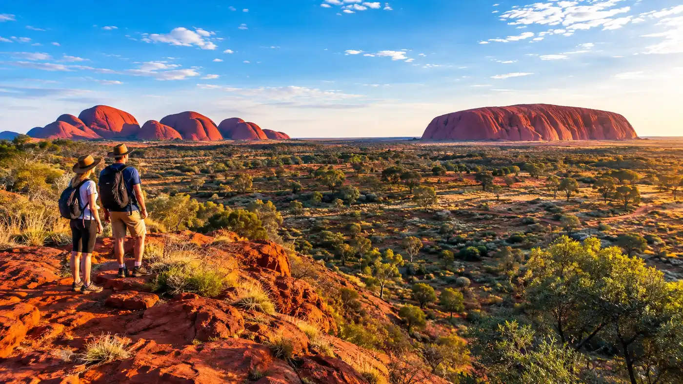
Most people travel out to the Red Centre with a single postcard image fixed in their heads. They want to see the great sandstone monolith glowing orange at dusk. But after you spend a couple of days out here, something shifts. You look west across the red dirt spinifex plains and spot the massive domed heads of kata tjuta rising against the horizon like ancient giant knuckles. For a lot of travelers, this place ends up lingering in memory even longer than the big rock itself.
Planning your time in the Red Centre means deciding how far you want to push into the desert. While the giant domes sit right inside the same national park boundary, Kings Canyon beckons from several hours away in Watarrka National Park. Both make unforgettable day trips from your base at Yulara. Whether you have an extra morning or a couple of spare days, getting beyond the main icon reveals what the ancient landscape of central Australia is truly about.
Book your australia uluru tour experience:
Kata Tjuta Location, History, and Getting to The Olgas
If you pull up a map of kata tjuta, you will see it sits roughly 45 kilometers west of the Yulara resort village. People often ask how far are the olgas from uluru, and the drive takes right around 40 minutes along a quiet sealed road called Kata Tjuta Road. The geological name kata tjuta / mount olga stems from explorer Ernest Giles, who dubbed the highest summit Mount Olga in 1872 to flatter a European queen. Today, traditional Anangu owners refer to it by its true name, which roughly translates to "many heads." As for the kata tjuta pronunciation, locals pronounce it roughly as kah-tah choor-tah.
The place feels wildly different from Uluru. Instead of one single block of arkose sandstone, this site consists of 36 distinct conglomerate domes made up of granite, basalt, and schist pebbles cemented together by ancient mud. It looks like an enormous scatter of giant red pebbles tossed across the desert floor. In fact, geologists say both formations were born from the same mountain-building event some 500 million years ago, but erosion worked on them with entirely different results.
Note: Kata Tjuta is an deeply sacred men's area under Anangu law (Tjukurpa). Out of respect, keep your camera pointed only at approved public trails, and never fly drones anywhere inside the park boundaries.
Getting out here is straightforward if you rented a car at Ayers Rock Airport. You just drive through the national park entry station, show your digital park pass on your phone, and branch right at the roundabout. If you do not have your own wheels, multiple operators run regular morning and afternoon transfers, or you can book organized kata tjuta tours that combine transport with guided trail walking.
The Best Kata Tjuta Walks: Valley of the Winds and Walpa Gorge
Walking into the domes is where the scale of this place truly hits you. The red rock walls shoot up hundreds of meters overhead, blocking out the wind and cutting off your view of the desert horizon. You suddenly feel very small.
The premier hike in the area is the kata tjuta valley of the winds walk. It covers a rugged 7.4-kilometer loop through steep gullies, rocky creek beds, and silent spinifex hollows. The full loop usually takes about 3 to 4 hours depending on how often you stop to catch your breath. The track climbs up to Karu Lookout first, which is manageable for most fitness levels, before descending into the heart of the domes toward Karingana Lookout. Standing in that narrow gap with the desert wind rushing between two immense rock faces is one of the grandest outdoor moments in all of Australia.
If you want something gentler, Walpa Gorge offers an easier alternative. It is a 2.6-kilometer return stroll along a raised boardwalk and gravel path, following a stream bed between two massive domes. Walpa means "whistling" in the local Pitjantjatjara tongue, named after the breeze that funnels through the gorge. The walk takes roughly an hour and offers deep shade during the middle hours of the day, with rare desert spearwood trees clinging stubbornly to the rock faces.
- Valley of the Winds Loop: 7.4 kilometers, rough rocky terrain, takes about 3.5 hours, closes when temperatures reach 36°C.
- Karu Lookout: 2.2 kilometers return, moderately steep steps, allows you to glimpse the inner valley without committing to the full loop.
- Karingana Lookout: roughly 5.4 kilometers return, steep descent and climb, delivers the most dramatic view framed by sheer red walls.
- Walpa Gorge Track: 2.6 kilometers return, gentle climb along a creek bed, great if you have tired knees or small kids in tow.
Keep your eye on the thermometer. Parks Australia shuts the Valley of the Winds track at Karu Lookout at 11:00 AM on any day forecast to hit 36°C or higher. During summer months, that closure happens almost daily. If you plan to hike the full loop, you need to pull into the trail car park right as dawn breaks.
Sunrise and Sunset at Kata Tjuta: Choosing the Right Vantage Point
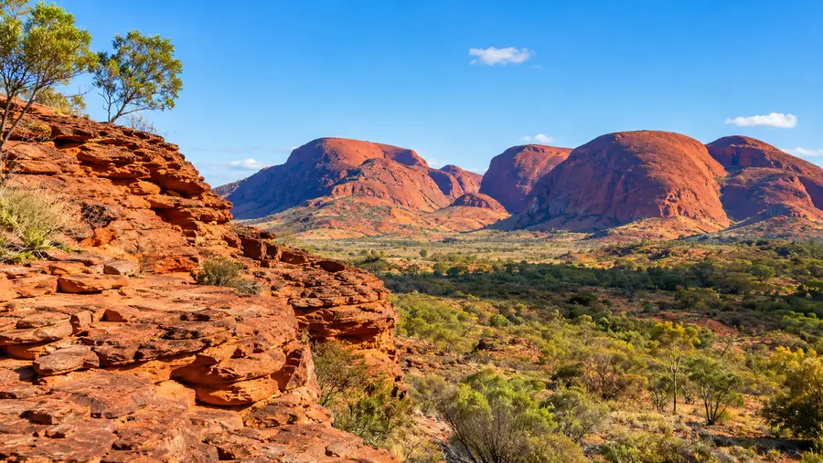
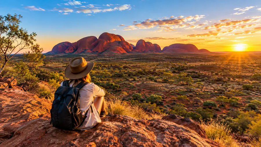
Watching the light change over the domes rivals any dusk show you will see at Uluru. Because the conglomerate domes have distinct gaps between them, the angle of the sun casts wild shadows across the rock faces that change minute by minute.
For sunrise, head straight to the kata tjuṯa dune viewing area. Located about 26 kilometers down the access road, a short wooden boardwalk leads up onto a red sand dune. Looking west, you watch the giant shapes of the Olgas awaken from dark navy silhouettes into glowing crimson domes. Turn your head completely around to the east, and you can see Uluru sitting isolated on the distant horizon, catching the very first rays of morning light. It is one of the only places where you can take in both icons simultaneously without leaving your footprint in the fragile sand.
Pro tip: Skip the crowded sunset coach parking area and head to the designated Kata Tjuta sunset viewing area with a thermos of hot tea or a cold drink about 45 minutes before sundown, when the rock faces flare up in deep burgundy.
Sunset is equally striking from the dedicated sunset viewing area near the western end of the access road. The late afternoon light hits the western faces directly, turning the conglomerate rock into a deep, glowing furnace before the desert cool rolls in. Taking a guided kata tjuta sunset tour is an easy way to experience this if you prefer letting someone else navigate the dark desert roads back to the resort.
Book your australia uluru tour experience:
The Long Journey: Kings Canyon Day Trip from Uluru
Kings Canyon sits in Watarrka National Park, roughly 300 kilometers north-east of the resort. A lot of travelers look at a map, see the distance, and wonder if a kings canyon day trip from uluru is genuinely worth the massive effort. If you love serious hiking, breathtaking cliffs, and striking geology, the answer is a resounding yes.
The uluru to kings canyon drive takes about 3.5 hours each way on completely sealed roads. You follow the Lasseter Highway east for 130 kilometers, turn north onto the Luritja Road, and cruise past wide plains of desert oaks and salt pans until the George Gill Range rises in the distance. If you join an organized ayers rock kings canyon tours coach, expect a very early pickup around 4:30 AM, arriving at the canyon rim right as the morning light begins illuminating the sheer sandstone cliffs.
The main reason to make this long journey is the famous Kings Canyon Rim Walk. It is a 6-kilometer circuit that starts with a notoriously steep climb known locally as "Heartbreak Hill" or "Heart Attack Hill." There are around 500 uneven rock steps straight up the cliff face. Once you conquer that initial 20-minute slog, the trail levels out into a wonderland of weathered sandstone domes called the Lost City, resembling a cluster of ancient beehives. Halfway through, wooden staircases lead down into the Garden of Eden, a cool, shaded oasis surrounded by cycads and gum trees around a permanent waterhole.
- Total driving time: roughly 7 hours return from Yulara on fully sealed bitumen roads.
- Fuel stops: Kings Creek Station and Kings Canyon Resort both sell diesel and unleaded, but fill up at Erldunda or Yulara to avoid premium remote pricing.
- Trail difficulty: the Rim Walk has an intense opening climb, while the 2-kilometer Kings Creek Walk on the canyon floor is flat and easy.
- Scenic flight option: booking kings canyon helicopter flights gives you a bird's-eye view of the canyon fissures and hidden waterfalls that foot trails cannot reach.
If the weather is scorching or someone in your group has mobility restrictions, the Kings Creek Walk offers an easy alternative. It traces along the canyon floor beneath towering sheer walls of red sandstone, terminating at a peaceful viewing platform under the gorge canopy. For more advice on planning your central Australian adventures, take a look at our complete guide to things to do in Uluru.
Comparing Kata Tjuta and Kings Canyon Day Trips
If your itinerary only allows time for one big excursion beyond Uluru, choosing between these two depends entirely on your travel pace, your vehicle, and how much driving you can tolerate in a single 24-hour window.
Kata Tjuta requires very little travel effort. You can leave your hotel room at 5:30 AM, complete the Valley of the Winds hike, stop by the dune lookout, and be back at the resort poolside by 11:30 AM before the midday heat turns oppressive. It fits easily into any standard 3-day itinerary without wearing you out. Kings Canyon, by contrast, demands a full 12 to 14-hour marathon day. It is an exhilarating expedition, but you will arrive back at your hotel exhausted, dusty, and ready for sleep.
| Feature | Kata Tjuta (The Olgas) | Kings Canyon (Watarrka) |
|---|---|---|
| Distance from Yulara | 45 km (one-way) | 302 km (one-way) |
| Driving Time | 40 minutes | 3.5 hours |
| Main Trail | Valley of the Winds (7.4 km) | Rim Walk (6.0 km) |
| Trail Highlight | Karingana Lookout | Garden of Eden rockhole |
| Park Pass Needed | Yes (Uluru-Kata Tjuta pass) | Yes (NT Parks pass) |
| Time Needed | Half-day (4-5 hours) | Full day (12-14 hours) |
If you are driving yourself toward Alice Springs after visiting Uluru, Kings Canyon makes a fantastic overnight stop along the Mereenie Loop rather than a back-and-forth day run. If you are flying in and out of Ayers Rock Airport, however, you might want to review our breakdown on how to get to Uluru and plan road transfers before deciding to tackle that 600-kilometer round trip in a single day.
Frequently Asked Questions about kata tjuta
What is the best time of year to visit Kata Tjuta and Kings Canyon?
The cooler winter and shoulder months from May through September are best. Daytime temperatures generally hover between 20°C and 25°C, making the long rocky hikes comfortable. During summer, valley temperatures routinely pass 40°C, triggering mandatory trail closures by mid-morning for walker safety.
Can I drive a standard 2WD car to both locations?
Yes. The roads from Yulara to Kata Tjuta and the main highway route to Kings Canyon via the Lasseter and Luritja Highways are fully sealed bitumen. You only need a 4WD if you intend to continue past Kings Canyon along the unsealed Mereenie Loop dirt road toward Alice Springs.
Do I need separate national park passes for Kata Tjuta and Kings Canyon?
Yes, you do. Kata Tjuta sits inside a federally managed park covered by the standard Uluru-Kata Tjuta National Park pass. Kings Canyon sits within Watarrka National Park, which is run by the Northern Territory government and requires its own separate NT Parks digital booking pass.
Quick Reference
- Kata Tjuta is 45 km west of Yulara; Kings Canyon is 302 km north-east.
- Valley of the Winds loop closes at 11:00 AM on days forecast 36°C or higher.
- Kings Canyon Rim Walk begins with a 500-step climb up Heartbreak Hill.
- Separate park passes are required for Uluru-Kata Tjuta and Watarrka.
Book your australia uluru tour experience:
My Take
Central Australia has a funny way of upending expectations. People fly out here for the solitary red rock they saw on television, but they end up talking about the roaring desert winds between the domes of Kata Tjuta and the towering canyon drop-offs at Watarrka. If your schedule allows, set your alarm before first light, pack more water than you think you need, and head out past the resort perimeter to experience the untamed landscape of the Red Centre firsthand.
Read more about australia uluru tour.